Sunday 16 November 2008

Scenic South Coast NSW


South Coast NSW
Originally uploaded by LeeFamily
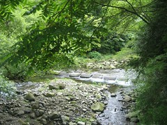
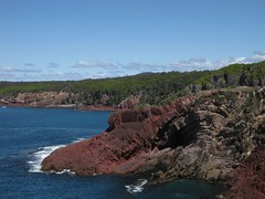
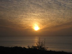
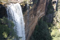
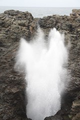
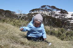
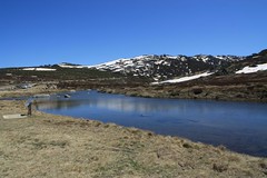
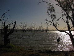
The Sydney-Melbourne Coastal Drive is one of Australia's most scenic touring routes. Our family travelled this route in the week of 29 Sep 2008. Using the Princes Highway and along scenic coastal roads, it took us through a tapestry of rustic country towns and fishing villages. When we travel inland we passed rich dairy pastures and vineyards that are the source of some of Australia’s finest cheeses and wines. We visited national parks, beautiful surf beaches and pristine lakes.

Rustic Bridge
Originally uploaded by LeeFamily
We travelled pass Kiama, Jervis Bay, Moolymook, Bateman Bay, Narooma, Bermagui, Tathra, Merimba, Pambula to Eden; all strange Australian Aboriginal names/ Our first stop was Callala Beach where we rented a beach house for seven days.

Sunset on Jervis
Originally uploaded by LeeFamily
We arrived in pitch black darkness to a bungalow, 77 Quay Road, on the beachfront of Callala Beach. By then James had exhausted himself crying all the way from Kiama. He did not like being strapped in an infant car seat and driven along unlit roads.

Callala Beach Dolphins
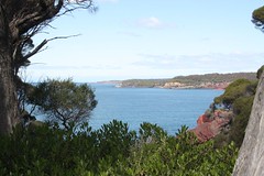
Callala Beach is a 4 km stretch of white sandy beach on the northern shore of Jervis Bay. A family of 6 bottle-nosed dolphins greeted us as they swam past the house each morning. I guess they were checking out the new residents. One day they paraded up and down the shallow waters of the beach, making U-turns close to the beach in front of the house.

Saturday 15 November 2008

A Whale of a Time - Jervis Bay

Jervis Bay
29 Sep 0 5 Oct 2008 Jervis Bay is one of the true gems of the NSW south east region. It measures about 15 km from north to south and about 10 km across. The enclosure shelters this part of the South Coast shoreline from the Pacific Ocean along the eastern sea-board south of Sydney. Its calm waters provide a resting haven for migrating humpback whales returning to the Antarctic after spending the winter at the warmer waters near the Great Barrier Reef.

A Whale of a Time
Originally uploaded by LeeFamily
The main town is Huskisson, where you can hire dolphin-watch cruises, fishing trips and boats, but it’s the natural beauty of the area that seduces. Aboard a whale watching vessel we had a close encounter with a mother humpback and her calf. This was James' first encounter with whales as with koalas, lizards and kangaroos. To observe them up close in their natural habitat is surely a treat.

Booderee End

Jervis Bay is reputed to have the clearest waters and whitest sands in the world. These beautiful blue waters are home to many dolphins and the opportunity to sight these graceful locals is one of the major features. We were able to swim; the water being very cold at first but became surprisingly pleasant once one equilibrates the body with sea temperature. John took to the water immediately since he was so deprived with England being so cold.


Booderee Telegraphic Creek Trail
At its southern end, Jervis Bay is enclosed by Booderee National Park, a pristine coastal wilderness. One afternoon we went to the park at the entrance to the bay. With James strapped like in a papoose on John's back, we walked one of the easiest nature trails, Telegraph Creek Trail. It is one of the national parks returned to the aborigines and managed by them. The Park includes Green Patch Beach and other notable beauty spots such as Hole in the Wall, Bristol Point and Scottish Rocks. A ruined lighthouse on the southern side of Jervis Bay is also well worth exploring. We went there at sunset and had a breathtaking view of the entrance to Jervis Bay.

Fritzroy Falls
Originally uploaded by LeeFamily
Kangaroo Valley presents a picturesque drive up gradual slope and down gentle valleys. We stopped at Fitzroy Falls which is a sheer drop of eighty metres of waterfall past sandstone cliffs, splash with mightily onto the black rocks below then continue in another fall nearly forty metres into the rainforest valley below. A pleasant 2 km walk around the falls provided spectacular views from their well placed lookouts of the falls and valley scenery. Other, lesser known sets of falls can be found by following these walking tracks, including the beautiful Twin Falls well worth the relatively short walk. We were fortunate to spot a lyrebird.

Kiama Blowhole
Originally uploaded by LeeFamily

The Kiama blowhole is a natural rock formation that traps a large volume of air within a small cavern. With the gush of the next wave, the seawater is forced up an opening resulting in geyser-like fountain of spray. Kiama is the aboriginal word for ‘the sea is speaking’. We fetched Becky from the Kiama train station to complete the entire Lee-Gifford family of 6 wise owls the term Pat uses to call us. 


Friday 14 November 2008

Pambula and Ben Boyd Nat Park


Ben Boyd Nat Park
Originally uploaded by LeeFamily
Friendly Kangaroo
5 - 8 Oct 2008 Pambula Beach was 4 hours from Jervis Bay. Enroute we were led up the hill on a mountain road in Mimosa Rocks National Park by the Garmin GPS navigator. There was no possible route forward requiring backtracking down the hillside.

We stayed at a cabin-like lodging called #1 Heaven. Next morning the Kangaroos were all over the streets. James had his first close look of the Kangaroos in the wild.Becky and I went whale watching up the Marimbula coast and had a real treat of 4 inquisitive humpbacks. They waved their flippers at us, poked their noses right up the side of the boat, the True Blue whale watching company.
Ben Boyd Tower
Ben Boyd National Park. This park is named after Benjamin Boyd, a prominent 19th-century Far South Coast entrepreneur. Its rugged coastline is a colourful display of folded red rocks, standing out against the sapphire blue waters of the Pacific Ocean. At the Boyd watchtower, one humpback whale mother and 2 calves were playing very close to the shore. We watched fascinated as they gamboled in the water and waved their tails. We counted at one time the mother slapping her tail on the water surface a total of 10 times

Thursday 13 November 2008

Snowy River


Jindaybyne Lake
Originally uploaded by LeeFamily

8 to 10 Oct 2008 We stayed at the Highland Lodge managed by Patrick and Katrina. There are cows, chicken, ducks, geese, guinea fowls, a donkey and two alpacas. It is a small farm. James got to watch us feed the chickens each morning. Jindabyne is the main town along the pass through the Snowy Mountains from the coast of NSW towards the Murray River basin of Victoria.


Kosciuszko National Park
Originally uploaded by LeeFamily

Modern Jindabyne was created in the late 1960s when the original town was relocated by the Snowy Mountains Authority for the Snowy Mountains Hydro-Electric Scheme. The original town now lies under the waters of Lake Jindabyne an artificial lake. The highest ski fields in Australia, all within Kosciuszko National Park


It encompasses Mt Kosciuzko (the highest mountain in Australia at 2228m), the headwaters of the famous Snowy River. John, Debbie and I brought James to have his first experience of snow at Charlotte Pass.

Wednesday 12 November 2008

Kayak Down the Murray

Together at the Murray River
10 - 17 Oct 2008 The Murray River is one of the longest navigable rivers in the world, stretching 2,700 kilometres from the mountains of the Great Dividing Range in north-eastern Victoria to journey's end near Adelaide in South Australia. The Murray region is home to lakes and rivers, sand dunes and desert, stands of red gum forest, spectacular sunsets and ancient aboriginal history.


Kayak down the Murray
 The river offers excellent flat water canoeing experiences with no rapids or white wat. At the resort, James enjoyed the indoor heated pool and swam everyday Debbie, John, Becky and Lionel spent a morning kayaking down the Murray Riverer. We hired two kayaks from a local operator and explored the river, paddling calm waters beneath red gums and stopping at shady riverside clearings for a bushland picnic or spot of fishing. At the same time Pat and Lionel had 2 rounds of golf at the Yarrawonga and Border Golf Club


Yarrawonga-Mulwalla combines a magnificent sunny climate, recreational facilities & home comforts... Close by Lake Mulwala is the centre of water activities with waterskiing, windsurfing, canoeing, swimming, fishing and cruising restaurants. The twin towns of Yarrawonga-Mulwala, separated by the Murray River, boast a large and beautiful man-made lake and attract holiday makers, golfers, anglers, tennis players, aquatic sports fanatics, bush walkers and campers from all over the world.

Rutherglen is the town famous for the wineries around it. The first planting of grapes for wine occurred in the 1850s. Spring is not a time of harvest, yet the green scenery, clean air and clean rivers make the valley a perfect backdrop for an inspirational food and wine tasting. That was exactly what Pat, Becky and I did. The three of us tasted and bought the wines at Buller, Campbell and the Stanton and Killeen wineries. We ate a sumptuous lunch at the All Saints winery. We found that the vineyards would serve delicious meal and we returned with the Giffords for a meal at the Pepper Sisters

Tuesday 11 November 2008

Canberra - Last-stop Ambledown Brook


Last Stop Ambledown


17 to 18 Oct 2008 “Last Stop - Ambledown Brook” is set amongst rolling countryside overlooking the Brindabella ranges just outside Canberra in the A.C.T. It offers the romance of a bygone era and a chance to unwind in unique surroundings.


We stayed in a restored 1929 Melbourne tram which has a double and twin bedroom, a cosy sitting room, adjoining bathroom and breakfast area. The view of the Brindabella range is very beautiful. The rustic and old fashion feeling in the train carriages made our

Thursday 26 June 2008

Hakone And The Elusive Mount Fuji 16 to 21 June 08


Elusive Mt Fuji, originally uploaded by Lee Family
The allure of Mt Fuji beckons as Pat and I decided on an annual holiday in Japan. Last year we sighted the snow capped mountain every morning from our ryokan(family-run inn) window in Fujiyoshida, Japan's 5 lake district. This year we spent one week in Hakone. Alas, Mt Fuji proved elusive. Hakone is shrouded with the mountain mist and the sun hardly shone through the heavy cloud cover. We managed to catch but one fleeting glimpse of the mountain from inside the cable car at the Ubako view point. The view this time was not of a perfect white ice-cream cone. Instead it was picture of a peak streaked with snow melting under the early summer sun. This was the only sighting we had!

Hakone River
Originally uploaded by LeeFamily

We arrived at Sun Hotel Resorpia, our 6 nights time-share exchange after a A380 airbus flight, the Narita Express to Tokyo, Shinkansen Kodama bullet train to Odawara, the Odakyu line to Hakone-Yumato. From there we boarded the mountain train, the Hakone-Tozan rail to Gora.

The Hakone-Tozan mountain rail company celebrated its 120th anniversary this year having been founded in 1888. In summer one could call it the Hydrangeas (Ajisai) Trail since both sides of the tracks are lined with a plethora of colours from the blooms of this plant. This train climbed several hundred metres up the mountain on a switch back system. This probably reduces the length of journey. The small train zig zags its way back and forth with trains switching with each other at the end of 3 switchbacks.

The resort sits on the slope of Mount Sounzan. To reach it we had to travel on a funicular railway to Naka-Gora. In our haste we got out on the wrong side of the tracks. We needed to cross to the other side but there was no bridge. The only way possible was to wait for the next train to arrive and use the train as the linkway to cross over. Picture crossing the carriage crowded with tourist and dragging our luggage behind us!


Owakudani Sulphur Hot Springs
Originally uploaded by LeeFamily

A 3-day Hakone Free pass costing ¥4400 (S$57) allowed us unlimited travel around Hakone region and several discounts to museums and restaurants. We used it to our heart's content the next day, 16 Jan 2008. Starting from Naka-Gora station which is next to Resorpia we took the first Funicular railway trip up to Mt Souzan. We were too early for the cable car but took the liberty to refresh ourselves with the floral scented fresh air, mountain mist and slight drizzle. The double carriaged cable ride led us up the thick mountain mist to the peak with zero visibility of the valley below.

A brief stopover at the Owakudani sulphurous hot springs valley allowed us to buy the famous Kurotamago black eggs. These eggs are hardboiled in the hot watery mud of the springs causing the shell to be blackened. It is said eating one of these eggs would extend lifespan by 7 years. In which case, Pat and I added 21 years each since the smallest package is a bag of six consumed over 2 days. The air was filled with odorous hydrogen sulphide as we meandered our way between the hot sulphur beds. One must not stop for too long, they say because the gas can overwhelm the poor tired souls. So much for gaining 21 years each.

Tuesday 24 June 2008

Lake Ashi and Hot Springs


LakeAshi View from Detached Palace
Originally uploaded by LeeFamily
At Togendai we boarded the Tokan pirate ship crossing Lake Ashi. This is a plasmodium shaped lake which was formed by the volcano's last eruption 3000 years ago. It is about 25m deep. There were supposed to have been two potential vistas of the revered mountain but thick clouds added to our disappointment. Lunch consist of mountain vegetable soup and cold green soba.

Hakone Checkpoint
Originally uploaded by Leefamily
/

After lunch we visited the Hakone checkpoint which showed how the Shogunate controlled the only road from Kyoto to Edo. The diodoramas illustrated how guards controlled the traffic of merchandise and the passage of women.

Nearby, sited on a small island hillock is the Detached Palace, once the summer residence of the royal family. This is a small Victorian-style mansion which has a very good view of the Lake and on cle ar days, Fuji-san. We enjoyed the tranquil settings of a well-manicured Japanese garden. Eventually we found ourselves trekking under the shade of tall cedar trees of the Ancient Cedar Avenue. The Edo shogunate ordered the planting of these tall trees providing the weary Kyoto-Edo traveller shade from the warm summer sun and shelter from the wintry snow.


Japan08Tenzan
Originally uploaded by LeeFamily

We ended this long day with a refreshing dip in hot-springs. A visit to a Japanese Onsen is not for the shy and faint hearted. For one thing, the baths are communal and the next, bathers are supposed to indulge completely naked. It takes quite a while to get use to this lack of privacy but the Japanese use the bath for a good time of fellowship in a completely relaxed surrounding. One can presuppose that in these exposed surroundings, pristine settings lies the ingredients for honest unfettered relationships. The baths are separated between sexes of course for otherwise there will be no relaxation at all. So in the quiet wooded surroundings by the hillsides, we took our dips alternating between the hot waters of spring and the cold breeze blowing through the shaded forest. We enjoyed the sound of birds singing and the occasional butterfly flitting about the flowers leaves in the garden.